Log in
All resources
Create a design
9,296 Free Artworks of Map Collection
eran laor cartographic collection
english-language maps
maps from university of amsterdam special collections
atlas der neederlanden
copperplate print
special collections of the university of amsterdam
atlas der neederlanden deel v: holland 4. noord-holland
abraham deur
hendrik de leth
koninklijke bibliotheek
media contributed by cleveland public library
georg widmann
old maps of the dutch east india company - africa
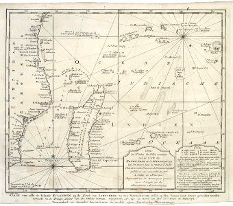
maps of the dutch east india company - madagascar
eran laor cartographic collection
pierre mortier
maps from the mechanical curator collection available to georeference
maps from the mechanical curator collection
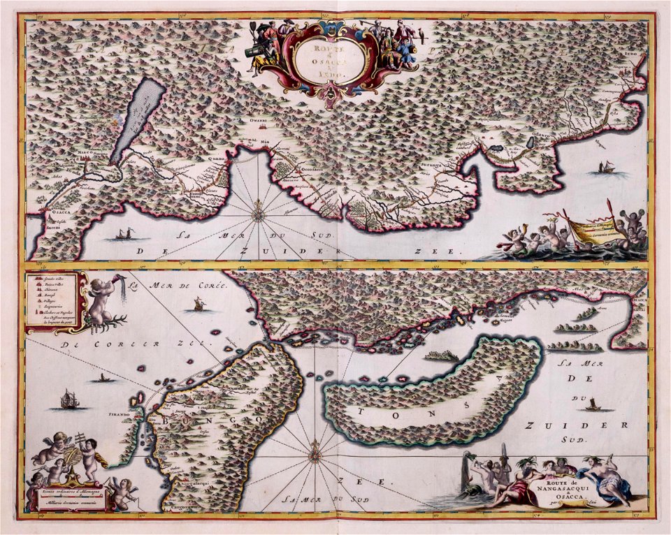
maps of the dutch east india company - japan
1669 maps
maps of the west-indische compagnie
1662
maps of the west-indische compagnie
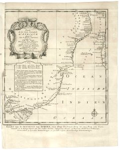
1747 maps of africa
maps of the west-indische compagnie
1747 maps of africa
maps of the west-indische compagnie
1747 maps of africa
maps of the west-indische compagnie
1747 maps of africa
maps of the dutch east india company - india
1755 maps
maps of the west-indische compagnie
1747 maps of africa
maps of the west-indische compagnie
1671
vrbivm praecipvarvm totivs mvndi (1612)
maps of dokkum by braun & hogenberg
vrbivm praecipvarvm totivs mvndi (1612)
maps of bolsward by braun & hogenberg
maps of helsingborg by braun & hogenberg
vrbivm praecipvarvm totivs mvndi (1612)
maps in the british museum
1780s maps of france
maps of the electorate of cologne
maps made in the 18th century
maps in the british museum
old maps of dunkerque
old maps of algiers
maps from gallica
eran laor cartographic collection
emanuel bowen
eran laor cartographic collection
emanuel bowen
eran laor cartographic collection
thesaurus philopoliticus
maps of paris from bibliothèque nationale de france
bird's eye view maps of paris
17th-century maps of cambridgeshire
old county maps of cambridgeshire
maps of antwerp city walls
old maps of antwerp
old maps of the dutch east india company - africa
1635 maps of africa
maps from university of amsterdam special collections
atlas der neederlanden
maps from university of amsterdam special collections
atlas der neederlanden
maps from university of amsterdam special collections
atlas der neederlanden
maps from university of amsterdam special collections
atlas der neederlanden
maps from university of amsterdam special collections
atlas der neederlanden
maps from university of amsterdam special collections
atlas der neederlanden
maps from university of amsterdam special collections
atlas der neederlanden
maps from university of amsterdam special collections
atlas der neederlanden
maps from university of amsterdam special collections
atlas der neederlanden
maps from university of amsterdam special collections
atlas der neederlanden
maps from university of amsterdam special collections
atlas der neederlanden
maps from university of amsterdam special collections
atlas der neederlanden
maps from university of amsterdam special collections
atlas der neederlanden
maps from university of amsterdam special collections
atlas der neederlanden
maps from university of amsterdam special collections
atlas der neederlanden
maps from university of amsterdam special collections
atlas der neederlanden
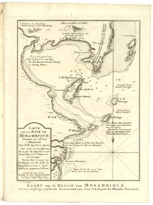
old maps of the dutch east india company - africa
maps of the dutch east india company - mozambique
maps by gerard valck
atlas beudeker
maps of paris from the david rumsey historical map collection
maps of paris by caspar merian
map of the circle of austria by sanson
1670s maps of austria
maps by johann christoph weigel
maps by christoph weigel
maps by johann christoph weigel
maps by christoph weigel
map of the circle of austria by sanson
1690s maps of austria
map of the circle of austria by sanson
1690s maps of austria
maps of alsace by guillaume sanson
maps by alexis-hubert jaillot
map of the circle of austria by sanson
1690s maps of austria
map of the circle of austria by sanson
1680s maps of austria
media from the national library of finland
classicism
1610s maps of the netherlands
maps with cartouches
prints by agostino veneziano in the british museum
maps in the british museum
prints by agostino veneziano in the british museum
maps in the british museum
lawrence h. slaughter collection of english maps, charts, globes, books and atlases
nypl lionel pincus and princess firyal map division
eran laor cartographic collection
willem blaeu
petit atlas pittoresque des 48 quartiers de la ville de paris, bhvp
proletarian literature
1700s maps of the ottoman empire
maps made in the 17th century
paintings in the museo correr
joseph heintz (ii)
media from the national library of finland
classicism
1858 van de velde maps of palestine and jerusalem
eran laor cartographic collection
1858 van de velde maps of palestine and jerusalem
eran laor cartographic collection
1858 van de velde maps of palestine and jerusalem
eran laor cartographic collection
1858 van de velde maps of palestine and jerusalem
eran laor cartographic collection
1858 van de velde maps of palestine and jerusalem
eran laor cartographic collection
1858 van de velde maps of palestine and jerusalem
eran laor cartographic collection
1858 van de velde maps of palestine and jerusalem
eran laor cartographic collection
1858 van de velde maps of palestine and jerusalem
eran laor cartographic collection
1858 van de velde maps of palestine and jerusalem
eran laor cartographic collection
1858 van de velde maps of palestine and jerusalem
eran laor cartographic collection
1858 van de velde maps of palestine and jerusalem
eran laor cartographic collection
1858 van de velde maps of palestine and jerusalem
eran laor cartographic collection
1858 van de velde maps of palestine and jerusalem
eran laor cartographic collection
1858 van de velde maps of palestine and jerusalem
eran laor cartographic collection
atlas schoemaker-noord-holland, amsterdam
old maps of amsterdam
eran laor cartographic collection
caspar merian
maps from the mechanical curator collection available to georeference
maps from the mechanical curator collection
eran laor cartographic collection
cornelis de bruyn
bodleian maps collection
old maps of oxford
turgot map of paris, david rumsey historical map collection – derivative files
palais royal (1634–1763)
maps by pieter mortier
1700 maps of africa
maps in the stadsarchief amsterdam
17th-century maps of amsterdam
koninklijk oudheidkundig genootschap, amsterdam
map of amsterdam, 1544
17th-century maps of saxony
old maps of vogtland
maps in the library of congress
1750s maps of central america
old maps of mozambique
1750 maps of africa
maps of the west-indische compagnie
1665
maps of paris from bibliothèque nationale de france
nouveau plan de paris by louis brion de la tour
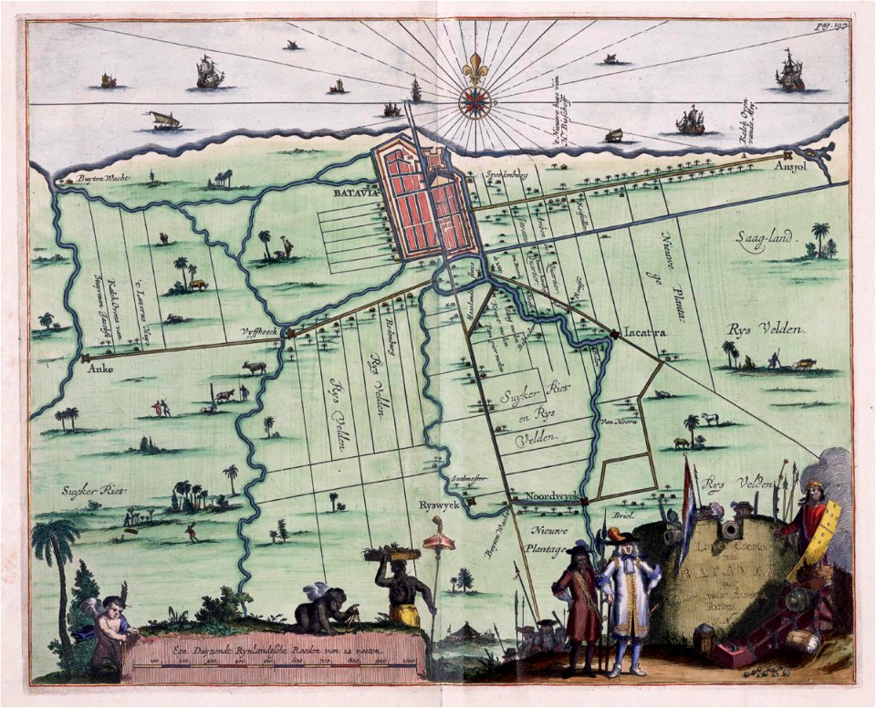
maps of the dutch east india company - indonesia
17th-century maps of batavia
maps from university of amsterdam special collections
atlas der neederlanden
führer durch dalmatien (1899)
old maps of dalmatia
david rumsey historical map collection
17th-century maps of iceland
maps of brest from bibliothèque nationale de france
maps from gallica
high renaissance,renaissance
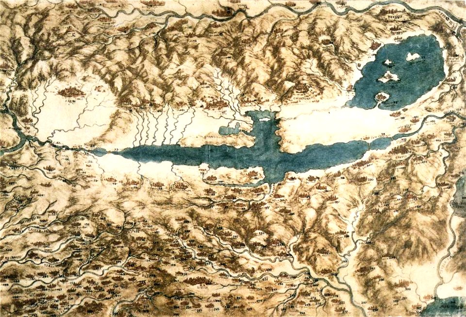
codex windsor
maps of the indigenous peoples of north america
renaissance
1823 maps of new york city
circular maps
1101 - 1200 of 9,296
Next page
/ 93